Michigan Space & Science Center Aerial Photos
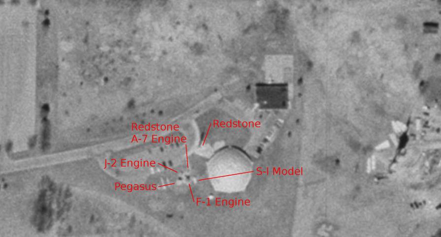
The Michigan Space & Science Center closed in 2003. Prior to that, it displayed a number of artifacts outdoors, and these artifacts were visible in the Google Earth imagery.
Unfortunately, Google didn't update its imagery very often prior to launching its own satellite, and so Google Earth has only one, black and white, photo of the MSSC while it was still open (this photo is dated April 7, 1999). I've annotated the locations of the Mercury-Redstone, Redstone A-7 rocket engine, J-2 rocket engine, F-1 rocket engine, Pegasus micrometeoroid satellite, and Saturn S-I (first) stage model:
Click image for a 1946x1050 pixel version of this image in a new window.
Imagery courtesy Google Earth.
Capture by heroicrelics.
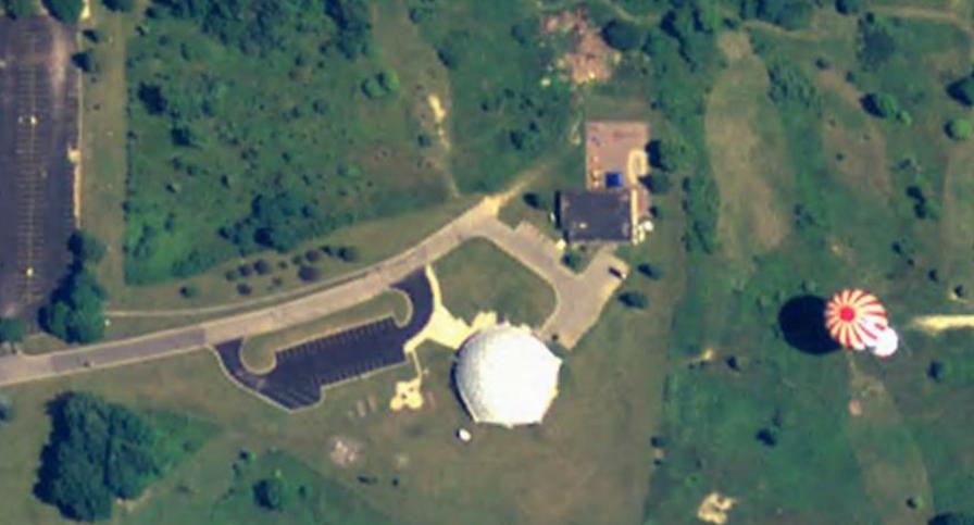
Google didn't acquire additional imagery until 2005 (with photos dated August 28 and December 31); this imagery still shows the concrete pads on which the rocket engines and Pegasus stood. This photo is dated December 31, 2005 (although, as a resident of a similar clime, I assure you that this image of lush greeenery is clearly not from December in Michigan):
Click image for a 1946x1050 pixel version of this image in a new window.
Imagery courtesy Google Earth.
Capture by heroicrelics.
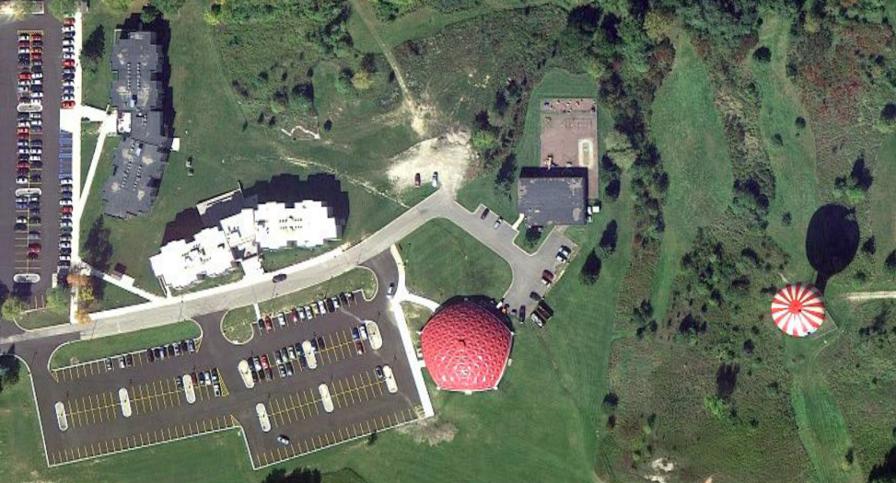
The Jackson Community College must be doing pretty well for itself: The April 20, 2004 photo shows the addition of the black-roofed building running north/south, and the next set of imagery, from June 22, 2011, shows the addition of white-roofed building running east/west. The June 2011 imagery shows that the concrete pads had been removed and the landscape was being prepared for the much larger parking lot, as seen in this October 4, 2011 photo. Between April and October 2011, the white geodesic dome also turned red:
Click image for a 1946x1050 pixel version of this image in a new window.
Imagery courtesy Google Earth.
Capture by heroicrelics.


