
Peenemünde Maps
A good deal of research and development into the German A4 (aka the V-2) was performed at the Peenemünde Army Research Center. This facility had laboratories, test stands, and (until largely destroyed by Allied bombardment) production facilities.
I present here two maps of Peenemünde.
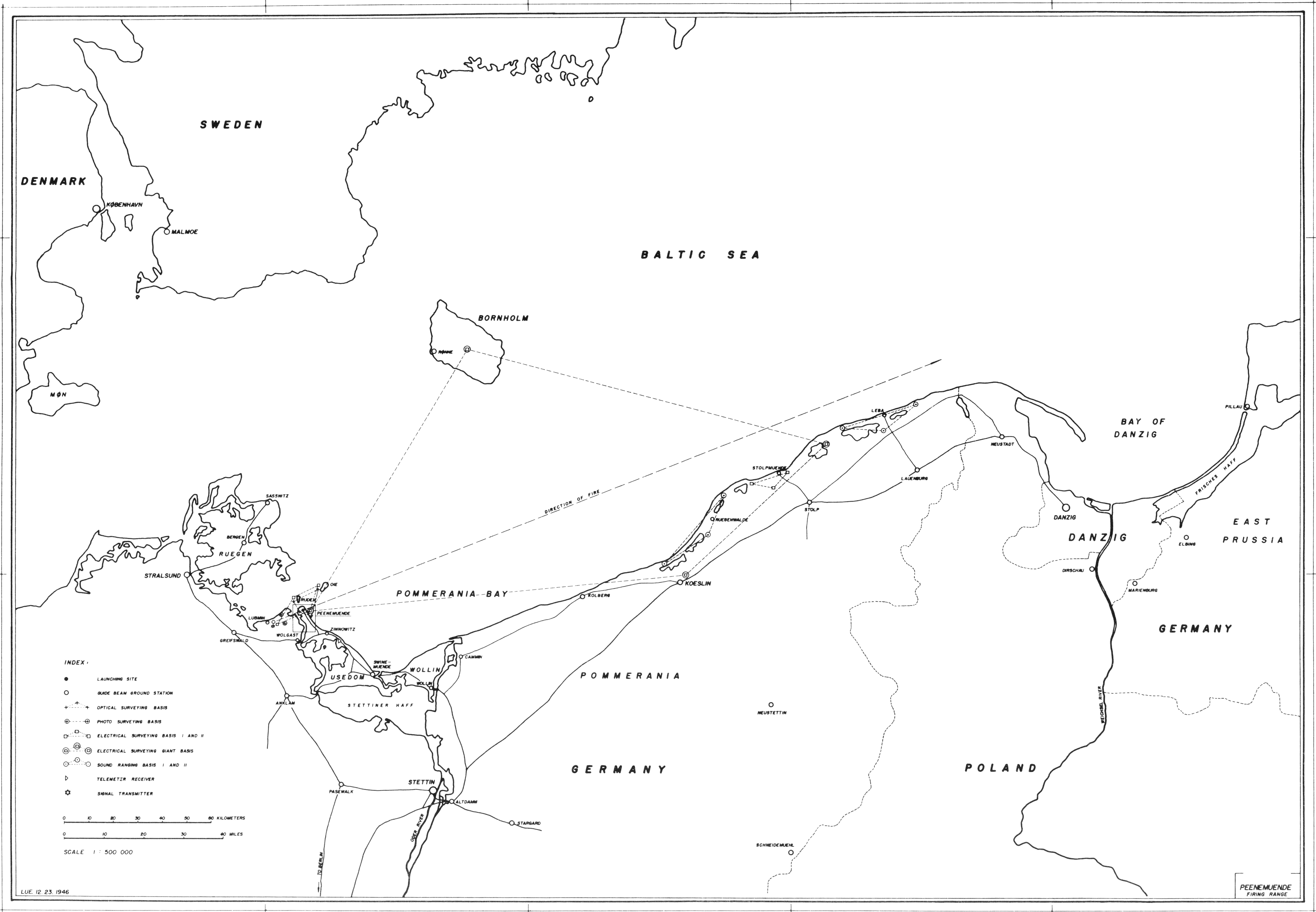
This first map shows Peenemünde's location on the Usedom Peninsula on the Baltic Sea, including the direction of fire for test launches:

Click image for a 1398x969 pixel version of this image in a new window or click
here for a 5590x3874
pixel version of this image in a new window.
From page vii of Technical Data on the Development of the A4/V-2,
located in the private collection of Dave Christensen (also available from the
NASA Technical Reports Server; alternate
link).
Scan and restoration by heroicrelics.
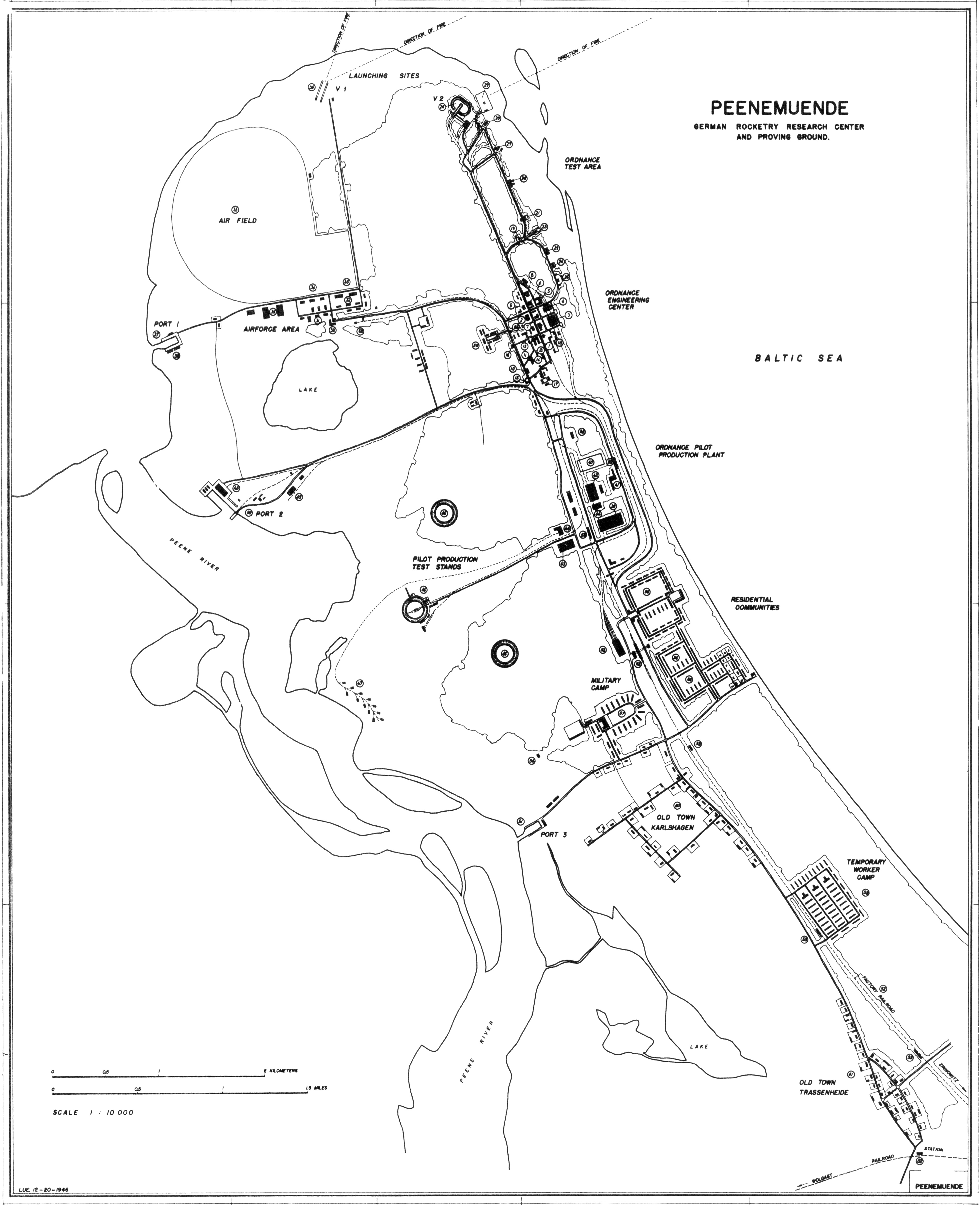
This map is an overview of the entire facility, including the Ordnance Test Area, Ordnance Engineering Center, Ordnance Pilot Production Plant, the the residential communities. Although many locations on this map are numbered, the key to this map unfortunately was not present in the source document, so I am unable to make the key available.

Click image for a 996x1224 pixel version of this image in a new window or click
here for a 3983x4895
pixel version of this image in a new window.
From page vi of Technical Data on the Development of the A4/V-2,
located in the private collection of Dave Christensen (also available from the
NASA Technical Reports Server; alternate
link).
Scan and restoration by heroicrelics.