Return to Neosho Missouri
Test Area
After visiting the former Rocketdyne plant, I tried to get close to the former test area (aerial view). From the aerial view, I saw that the foundations for Test Stand No. 2 and Test Stand No. 1 were still present.
As expected, all access to the test area was restricted. I did not, however, expect that the restrictions would be quite so far from the test area. The test area is located east of the former Rocketdyne plant, itself on the east side of Doniphan Drive. Armed with several pasted-together screen shots of a Google Map of the area, I attempted to at least see some of the test area.
Unfortunately, Google incorrectly placed the location of Premier Turbines (the most recent tenant of A.F. Plant No. 65) approximately three blocks farther south than the actual location of the plant. Although the access roads were named on the Google Map, they did not have any street signs or other identification. Thus, I began my quest three blocks too far north.
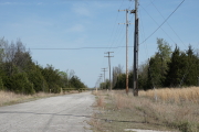
There was a road which appeared on the Google Map to go behind the plant and eventually lead to near the test area. I followed the road (which turned into a coarse, single-land road which seemed to curve much more than indicated on the map), only to find it eventually fenced off.
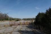
As it turns out, the fact that I started my search at a different road than I'd initially planned really didn't matter too much; most of the access roads are fenced off where they meet Doniphan Drive. Although I thought I was looking at Shaw Drive (which leads to what appeared to be the south entrance to the test area), it was Williams Avenue which I first found to be fenced off about a block east of Doniphan (Williams would have eventually dead-ended at a road which would have taken me to Shaw, if Williams had been open).
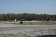
I tried the next access road (Hempstead), which was also fenced off. The fence at next road, Shelby, was open; there an R/C airfield which was open at the time. Shelby eventually curved and hooked up with Shaw Drive (which was the road for which I was initially searching), only to be fenced off at Roark Drive.
Four times rebuffed, I abanoned my quest. Even if I'd been able to get vaguely close to the test area, the countryside is heavily wooded and would have likely obscured my view.
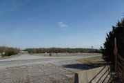
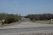
Note that calling these "roads" is a generous assessment. I'm sure that they were paved at some point in the distant past, because only a paved road can have potholes as large as the ones I encountered. Weeds and even small trees grew up through the pavement, and at some points the trees and shrubbery growing on either side of the road made the passage less than one lane wide.
 dscc3160.jpg |
 dscc3180.jpg |
 dscc3165.jpg |
 dscc3173.jpg |
 dscc3167.jpg |